Troost MAX
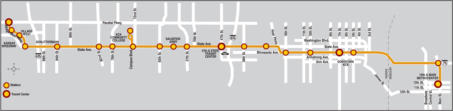
Troost MAX travels from downtown to the Crossroads district, Hospital Hill and south along Troost to Bannister. Troost MAX offers local service south of 75th Street. Other major destinations include the East Village development (currently under construction), Discovery Center, UMKC Hospital Hill and Main Campus, Rockhurst University, The Landing, Truman Medical Center, and Children’s Mercy Hospital. Park and Rides are located at 31st & Troost, 95th & Troost, and the Bannister & Hillcrest area. Trail Connections are a vital part of Troost MAX: a future trail between Troost & Bannister will connect to the Trolley Track Trail near 87th & Garfield.
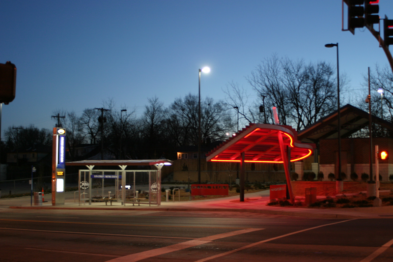
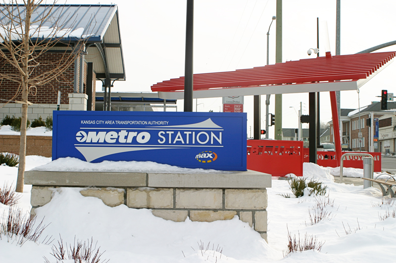
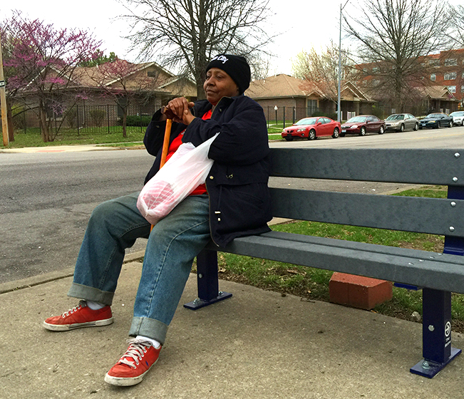
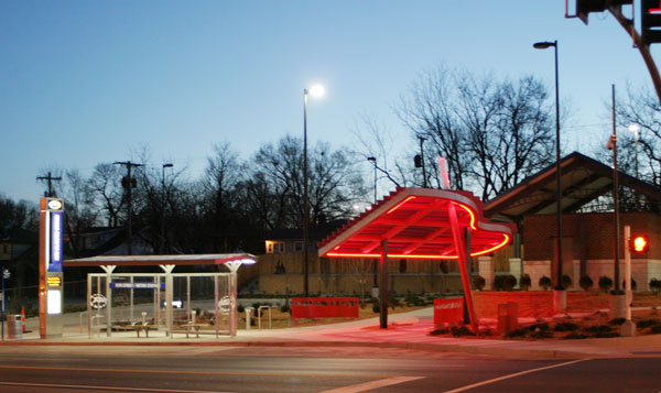
MAX stations are well-lit and feature a distinctive, easily identifiable information marker, and a specially designed passenger shelter. The stations are clearly marked and named, featuring easy-to-understand route maps and real-time transit information. Riders have instant and constantly updated access to the exact arrival time through GPS technology and real-time signs at MAX stations.
Troost MAX Artwork
For the first time, the Kansas City Area Transportation Authority has commissioned original public art at prominent locations along Troost MAX. Artists drew upon community input and local history to create interesting and compelling works.
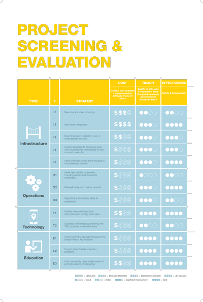
31st & Troost, “Catalyst,” Matt Dehaemers
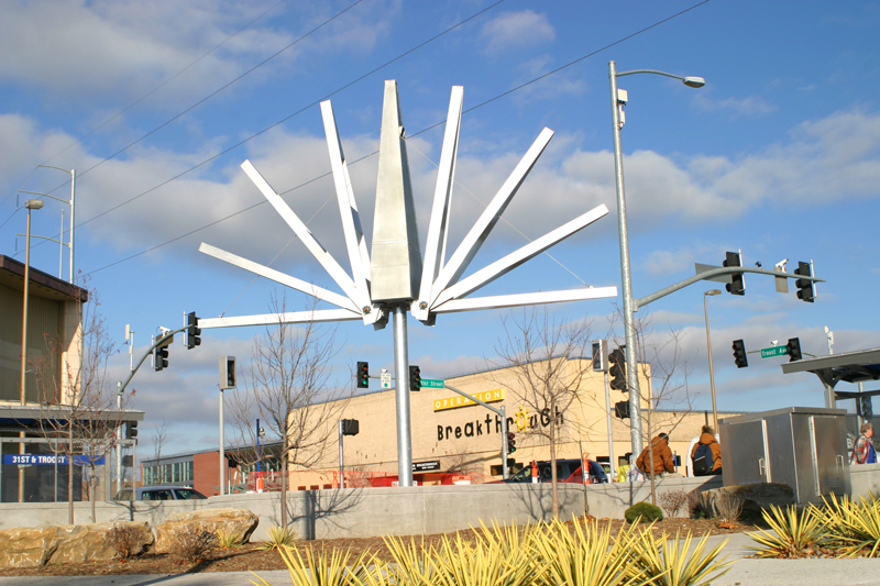
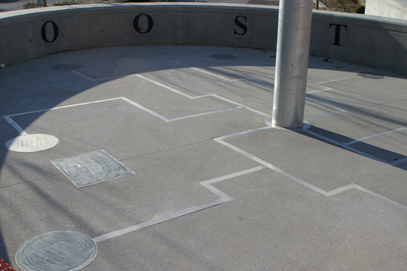
This large-scale incorporates linguistic history in the structure’s design. Dehaemers designed the structure to resemble a tree, playing off one origin of the word “Troost,” which can mean tree. The motion of the structure results in a creation that is constantly in flux, much like the history of Troost. Dehaemers recently completed Seven Sentinels at the city’s vehicle impound facility. Nationally, he has been recognized by the Public Art Network’s Year in Review for four years in a row starting in 2004, and again in 2009. See a video of the sculpture in motion.
39th & Troost, “Unite," Jefrë
![]()
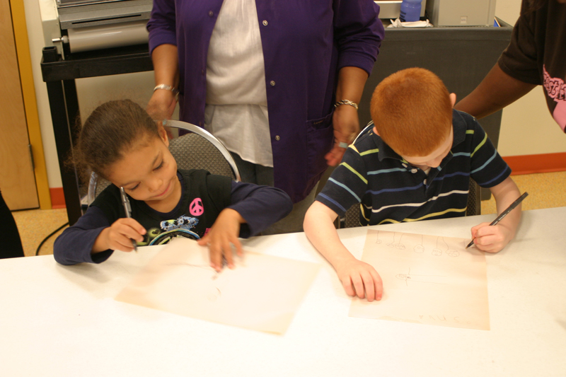
The Catholic Key covered the March 2011 dedication of Unite. Jefrë created a sculpture that draws on the image of hands coming together, evoking a joining together or way to cross a divide. The artist worked with area children, gathering drawings of what the children want to be when they grow up. These drawings of doctors, firefighters, engineers and other vocations are incorporated into the sculpture. Jefrë is an internationally acclaimed emerging public artist based in Miami who has received numerous awards for his innovative designs. After ten years working with international design firms, Jefrë launched his own couture public art studio in 2008 with a focus on environmental art, green roofs, boutique plazas, parks, and public art master plans. In his first year, he has been selected for six national blind public art competitions in New Orleans, Washington D.C., Toledo, Palm Beach, Orlando, and Philadelphia.
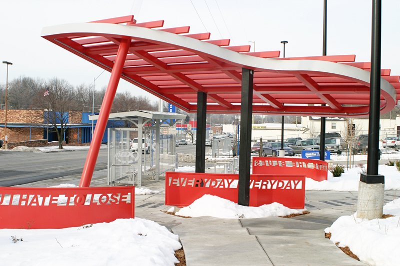
75th & Troost, “Every Day I Have the Blues,” David Dahlquist
![]()
The installation chosen for the 75th & Troost MetroStation is a tribute to Kansas City’s rich jazz history. The sculpture is an oversized piano structure with LED lighting. It is a powerful red epoxy painted steel and aluminum structure. The open, cantilevered framework suggests the raised lid of a grand piano; pedestrians can actually walk under the structure on a walkway or sit on benches resembling the piano’s keyboard. David B. Dahlquist is a nationally-recognized public artist and teacher. He is the Creative Director of RDG Dahlquist Art Studio, a comprehensive design and fabrication facility within RDG Planning & Design, specializing in the integration of artwork within building architecture and the landscape.
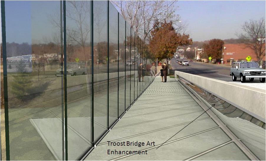
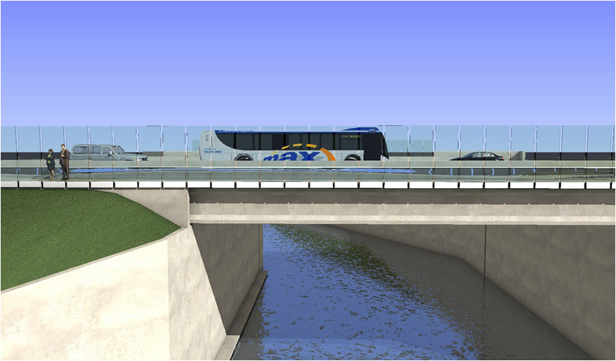
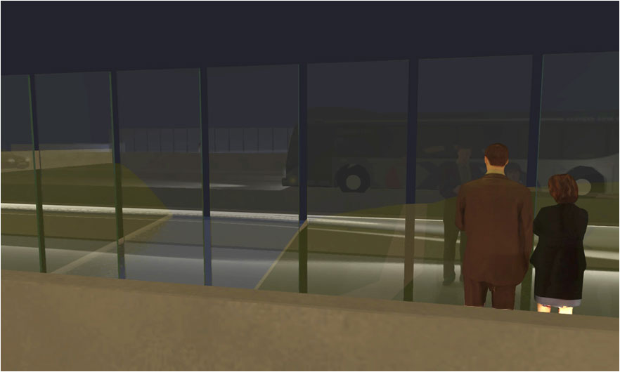
The Troost Bridge
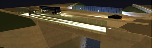
The new bridge over Brush Creek is a project of the City of Kansas City, Mo. On the pedestrian walkway of the bridge, a series of polished stainless steel of panels reflect light throughout the pedestrian walkways on the bridge. The panels will evoke the movement of the water flowing under the bridge, as well as the motion of the pedestrian, bicycle and transit traffic across the bridge. See drawings of the bridge: View from the pedestrian walkway Side view of the Troost Bridge at daytime View of the reflective glass wall at nighttime Side view of the Troost Bridge at nighttime
Green Technology
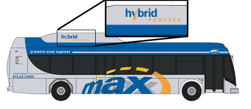
Troost MAX incorporates green features and technologies. The MAX fleet includes five hybrid electric buses. Hybrid buses operate on battery power from start-up until a speed of 25 mph at which time a diesel engine supplies power and recharges the batteries. This action reduces nitrous oxide emissions and increases fuel economy by 10%-20%. Other green features at select stations and park-and-rides include:
- Rain gardens at several MAX stations to capture and filter water run-off
- Posts or bollards that include solar-powered lighting
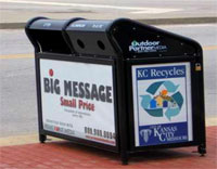
- Recycling receptacles
- Solar-powered trash compactors
- Pervious concrete that allows water to soak through to the subsoil, reducing the amount of polluted water that runs off of the pavement surface
Hybrid vehicle
Rain gardens at stations
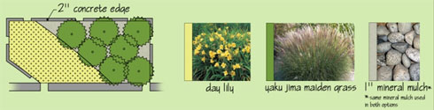
Recycling bins
Solar-powered lighted bollards

Funding for MAX
Capital federal funds were used for planning, construction, vehicles, stations, and technology:
- Total budget $30.6 million, $24.5 million from federal grants
- This includes $18 million for construction and fabrication
Local entities provided a required 20% match:
- KCP&L Streetscape Funding
- City of Kansas City, Mo., PIAC funds for streetscape
- Property and funds for Park-and-Ride at 31st & Troost
- Pedestrian improvements on Troost Bridge at Brush Creek
- Other ATA and city sources
Trolley Track Trail
The six mile trail from the Country Club Plaza to 85th & Prospect is owned and managed by the City of Kansas City, Mo.
Please contatct the City of Kansas City, Mo., Action Center with any maintenance issues:
- Call 311 or (816) 513-1313
- Twitter: Follow @KCMO311
TIGER Projects
TIGER (Transportation Investment Generating Economic Recovery) is a discretionary grant program of the U.S. Department of Transportation funded by the American Recovery and Reinvestment Act. In 2010, the Kansas City region was awarded, on a competitive basis, $50 million in TIGER funding to make transportation infrastructure improvements along several regional transit corridors and in the Green Impact Zone in Kansas City, Mo. To track the progress on these projects visit the TIGER Tracker.
Green Impact Zone
TIGER funds will be used to rehabilitate the infrastructure in the Green Impact Zone, focusing on better transit stop amenities, traffic-signal improvements, street resurfacing and sidewalk replacement, Troost Avenue pedestrian bridge, and other neighborhood improvements.
Missouri Corridors
Approximately $1.42 million in TIGER funds will be used for Missouri corridors transit improvements (North Oak Trafficway and U.S. 24 and U.S. 40 corridors in eastern Jackson County). The project consists of improving bus stops and increasing pedestrian access to and from these bus stops.
State Avenue Transit Improvements
A total of $10.3 million of the $50 million TIGER grant awarded to the Kansas City region was allocated to the State Avenue corridor. TIGER grant funds in the east-west State Avenue corridor in Kansas City, Kan., will support existing transit services through improved stops, shelters, pedestrian connections and building two new transit centers. The two new transit centers for the State Avenue corridor will be located at the corner of 7th Street and Minnesota Avenue and at the corner of 47th Street and State Avenue. These facilities will bring dedicated transit centers to downtown Kansas City, Kan. to facilitate transit connections and transfers.
Stop Optimization
Stop Optimization is a multi-faceted, comprehensive analysis of every bus stop in the system, a few routes at a time, aimed to improve:
- Service (quality, efficiency, safety, etc.)
- Accessibility (sidewalks, concrete connected to curb, etc.)
- Amenity allocation
This program addresses these goals by:
- Reducing the number of stops
- Relocation of and/or concrete improvements at remaining stops
- Addition, removal, or relocation of amenities based on ridership trends
The first, and most visible, component of Stop Optimization is the removal and merging of stops. Stops are initially identified for removal based on numerous factors, including stop spacing, ridership data, accessibility, existing amenities, nearby origin/destination points, etc., which are considered in conjunction with KCATA’s Service Guidelines and industry best practices. Prior to finalizing any removals, we consider all public comments received in response to rider alerts and bulletins indicating stops proposed for removal, ultimately keeping most stops with multiple comments
As of July 2016, Stop Optimization has resulted in 620 stops outside of downtown KCMO being removed from 22 routes, which represents roughly 27% of the stops outside downtown along those routes. Of the stops removed, 54% averaged less than one boarding per weekday and 88% averaged less than five.
How does removing stops benefit riders?
The simple answer is that by having fewer stops, we are able to provide quicker, more reliable service with less frequent stop-starts. While we cannot attribute all of the improvement to Stop Optimization, the most definitive demonstration that Stop Optimization has produced results in this capacity is the drastic on-time performance (OTP) improvement for 30 Northeast following implementation.
30 Northeast Saturday On-Time Performance
| January | February | March | April | May | June | |
|---|---|---|---|---|---|---|
| 2015 (pre-optimization) |
67.9% |
47.9% |
57.3% |
57.8% |
49.3% |
50.9% |
| 2015 (post-optimization) |
91.0% |
70.3% |
77.8% |
84.4% |
90.3% |
86.1% |
Additionally, by reducing the number of stops, we can better allocate limited resources to improve accessibility and amenities at remaining stops. So far, accessibility improvements have been achieved entirely by relocating stops, mostly from the nearside of intersections to the farside, which also has operational and safety benefits. By relocating stops we have improved accessibility at roughly 100 stops with minimal costs. We anticipate concrete improvements at roughly 20 high priority stops to begin before the end of the year.
The third component of Stop Optimization consists of removing benches, shelters, etc., from removed stops or those with relatively low ridership, and reallocating them to higher ridership stops, using the standards set forth in KCATA’s Bus Stop Guidelines.
Amenity Placement Standards
(Minimum average weekday boardings for new amenity placement)
| Amenity | Local Service | Commuter Service |
|---|---|---|
| Corner Schedule | 10 | 5 |
| Bench | 25 | 10 |
| Trash Can/Recycling Bin | 25 | 25 |
| Shelter | 50 | 25 |
| Second Shelter | 150 | N/A |
Amenity Removal Standards
(Threshold for removing an established amenity based on average weekday boardings)
| Amenity | Local Service | Commuter Service |
|---|---|---|
| Corner Schedule | less than 5 | less than 3 |
| Bench | less than 10 | less than 5 |
| Trash Can/Recycling Bin | less than 10 | less than 10 |
| Shelter | less than 25 | less than 15 |
| Second Shelter | less than 100 | N/A |
While these standards served as a guide, we made additions liberally and removals conservatively. A second wave of amenity additions will be made as ridership shifts from stop removals are fully understood with new ridership data.
Amenity Reallocation Summary
(As of July 1, 2016)
| Amenity | Number | Average weekday ridership at impacted stop |
|---|---|---|
| Shelter added | 4 | 288 |
| Shelter upgrade from bench | 4 | 65 |
| Bench added | 49 | 33 |
| Shelter removed | 15 | 4 |
| Bench downgrade from shelter | 16 | 15 |
| Bench removed | 37 | 3 |
As the chart indicates, there have been more shelters removed than installed and more benches installed than removed; however, far more riders have benefited from amenity upgrades than been inconvenienced by amenity downgrades. Additionally, quite a few locations identified for shelter addition/upgrade are among our top priority stops for concrete work improvements to improve accessibility and support a shelter. Lastly, while financial savings were not a primary consideration for the Stop Optimization program, removing the 31 shelters identified above, will save an estimated $275k/year in maintenance costs; resources that can be reallocated to upgrading and maintaining stops with higher ridership.
State Ave. Connex
Enhanced Transit Facilities for State Avenue
KCATA and Unified Government Transit secured federal TIGER funding to improve the Minnesota/State Avenue transit corridor. The improvements werew made along the transit route that begins at the 10th & Main Transit Center in downtown Kansas City, Mo., travels through Downtown Kansas City, Ks., and ends at Village West. The route serves activity centers and neighborhoods along State and Minnesota avenues.
Why Transit is Important to State Avenue
Effective transit connects employment centers, educational facilities, neighborhoods and shopping and entertainment areas. As a major east-west route through the Kansas City metropolitan area, State Avenue links Kansas City’s revitalized urban core with new development occurring farther west. With two new transit centers providing regional connections, State Avenue Connex supports the regional vision for enhanced and expanded regional transit in Kansas City. State Avenue Connex will improve transit facilities and continue to provide access to jobs, support economic development, and provide efficient transportation.
What’s Included with the Improvements
State Avenue Connex includes transit centers at 7th and Minnesota Avenue and at 47th and State Avenue (formerly Indian Springs). Both transit centers have been custom-built with improved passenger waiting areas and amenities such as real-time passenger information. Other State Avenue corridor Connex stop improvements include:
- Bus passenger shelters and benches
- Bus stop platforms
- Landscaping and environmentally friendly features
- Improved pedestrian connections
![]()
Click on the map for a closer view.
Design Process and Schedule
KCATA, UGT, business leaders, neighborhoods, elected officials, the general public, other stakeholders, and a consultant design team worked together to improve the State Avenue transit cooridor. The preliminary design process began in the spring of 2011, and final design was completed in early 2012. Construction began in Summer 2012 and finished in 2013.
How State Avenue Connex Improvements were Funded
A Transportation Investment Generating Economic Recovery (TIGER) Grant from the U.S. Department of Transportation is funding the State Avenue bus enhancements. The grant awarded included $10.5 million for the design and implementation of these physical enhancements along the corridor. State Avenue improvements are an intermediate step to a MAX Bus Rapid Transit Line.
View a Fact Sheet about the State Avenue project. [PDF]
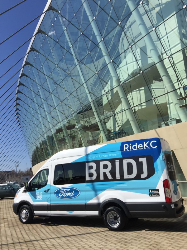
RideKC: Bridj Pilot
In March 2016, KCATA began a pilot program to test how on-demand services could integrate into the suite of transportation options available in the Kansas City region. The partnership between Bridj, KCATA, and Ford was the first U.S. public-private collaboration bringing together a major U.S. transit system, an automaker, and an urban technology company to enhance existing mass transit by providing greater mobility options.The pilot was designed to share our learnings within our community; to inform future project/programs decisions; and to provide a demonstration project to the global community of public transportation providers relating to how service adaptations are required to meet the needs of an ever mobile, connected populace.
As a component of the pilot program, researchers at the Transportation Sustainability Research Center (TSRC) at the University of California at Berkeley conducted an evaluation of the RideKC: Bridj pilot program. TSRC’s goal in its evaluation is to assess the travel behavior impacts of the service, as well as to provide operational and institutional analysis. The evaluation consists of multiple pieces of analysis, including a survey of users, a survey of those who have downloaded the Bridj app, and a community survey.
The evaluation is available here: TSRC Analysis (PDF).
ProspectUS
ProspectUS is a community-based process to prepare an equitable and transit-oriented investment strategy along the Prospect MAX route. ProspectUS is a great opportunity for Kansas City. It is an opportunity to acknowledge history and the impact of inequitable policies while also celebrating the families, leaders, and efforts that have contributed to the legacy of this historic community.
Get all the details at the ProspectUS website.
Transit-oriented development – or “TOD” for short – is a term used to describe an approach to community development that emphasizes walkability, equity, empowerment, and access. This type of development will encourage long-lasting investments that will support existing residents and transit riders, welcome new neighbors, expand opportunities for businesses and entrepreneurs, support mixed-income neighborhoods and housing options, and make Kansas City stronger. Investments in Main MAX and Troost MAX created a foundation for further investment in those areas. Recent investments in Prospect MAX transit provide a foundation from which the community and residents can benefit from improved access to the jobs, education, goods, and services this region has to offer. This process will allow the communities of the Prospect Avenue corridor to define their future and participate in its realization. The project is funded through a Federal Transit Administration grant awarded to City of Kansas City, Missouri and the Kansas City Area Transportation Authority (KCATA). The Prospectus project kicked off with community meetings in Summer 2022 and will continue through early Summer 2023.
et involved: https://www.prospectuskc.com/engagement 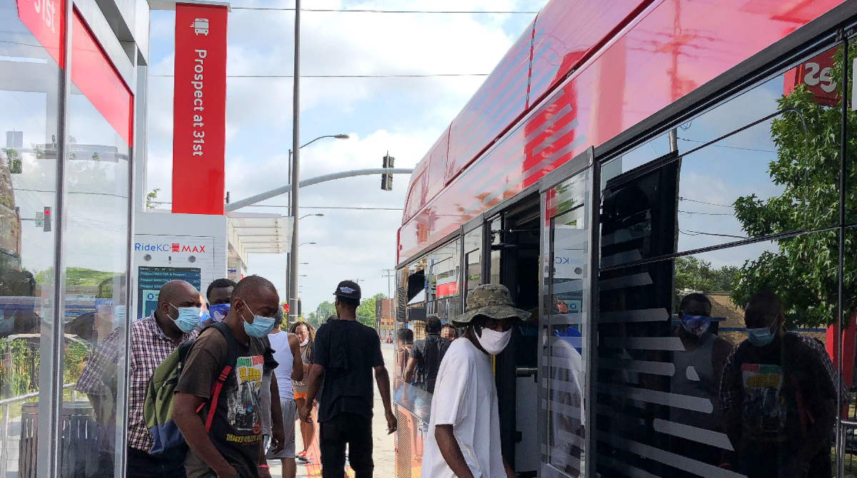
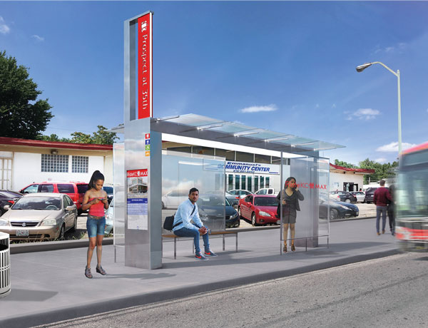
Prospect MAX
Prospect MAX service begins December 9!
After years of planning and building, Prospect MAX is almost ready to roll. By the end of 2019, the 10-mile Bus Rapid Transit (BRT) line will make its maiden voyage from Downtown to the new 75th & Prospect Transit Center at Alphapointe. Prospect MAX is Kansas City’s third BRT line.
Building off the success of Main MAX and Troost MAX, Prospect MAX offers BRT amenities like frequent service, upgraded MAX stations and vehicles, traffic signal priority at stoplights and fewer stops for faster service. Prospect MAX will also introduce customers to brand new BRT amenities.
Transforming a Community
Prospect MAX is a $56 million transportation investment in one of the highest ridership corridors in the region. Just take a walk along the 40,000 feet of built and repaired sidewalks, improved intersections and pedestrian access. This investment, made possible by local and federal funding, has made this corridor safer and more inviting for pedestrians, transit customers, and bike and scooter riders.
RideKC’s priority is returning economic and community value to our region through transit-oriented development – to enhance places where people are and create areas where people want to be.
When KCATA invests in transit, we’re investing in a stronger economy, more access to opportunity, a safer community and a great place to live, work and play.
Station Features
Here’s what’s new about Prospect MAX
- Level boarding: Several high ridership stations will have level boarding to help people get on and off the bus more easily and quickly. Level boarding is especially helpful for people who have trouble with steps or are pushing strollers or using wheelchairs or walkers.
- Ice-melting pavement: Also new to Prospect MAX is a special blend of concrete that de-ices pavement without the need for chemicals that uses electricity to melt away snow and sleet. This winter will be RideKC’s first ice melting test!
- Touchscreen technology and free WiFi: RideKC buses have offered free WiFi for many years, but now, Prospect MAX also offers free WiFi at stations. Waiting customers can access internet service to fill out job applications, order groceries or read an online book right at the MAX station.
- Two new transit centers with enhanced waiting areas, opening in 2020!
Paving the Way
Honoring local contributors along the route.
This program recognizes some of the people who have paved the way with significant contributions
in the neighborhoods along Prospect Ave. A short history and digital biography of their legacy will be available on the station kiosks.
Honorees will be recognized with granite tile plaques (pictured below) placed in the sidewalk at bus stops along Prospect Ave. with a short biography that is accessible on the bus shelters’ touchscreens. A public survey conducted in the fall of 2018 selected the first 10 honorees, with more to be selected later by the community.
Honoree announcement coming soon!
Operations
Bus service for Prospect MAX is patterned after Troost MAX, resulting in increased service, reduced travel times and stronger connections to neighborhoods. Below is a summary of the service details.
Station Design
Downtown Prospect Avenue MAX stations are designed to blend with the downtown streetscape, making it easier for pedestrian traffic on sidewalks.
Prospect Avenue MAX stations will feature an interactive smart kiosk, real-time bus arrival information, shelter protection from the elements and enhanced lighting for improved safety and greater visibility.
Funding and Implementation Schedule
With service similar to rail, MAX BRT operates at a fraction of the cost. KCATA estimates Prospect MAX project will cost approximately $54 million. The project will be funded through a mix of federal and local funds.
- Federal Transit Administration (FTA) Small Starts Program - $29.98 million
- Surface Transportation Program (STP) - $8 million
- City of Kansas City, Mo. - $12.5 million
- KCATA - $3 million
2016: Environmental Documentation, FTA Funding Decision, Approved CE, Project Development
2017: Final Design, Vehicle Purchase begins, Construction Grant Agreement
2018-2020: Construction
2019: Startup Testing & Operations, Begin Service
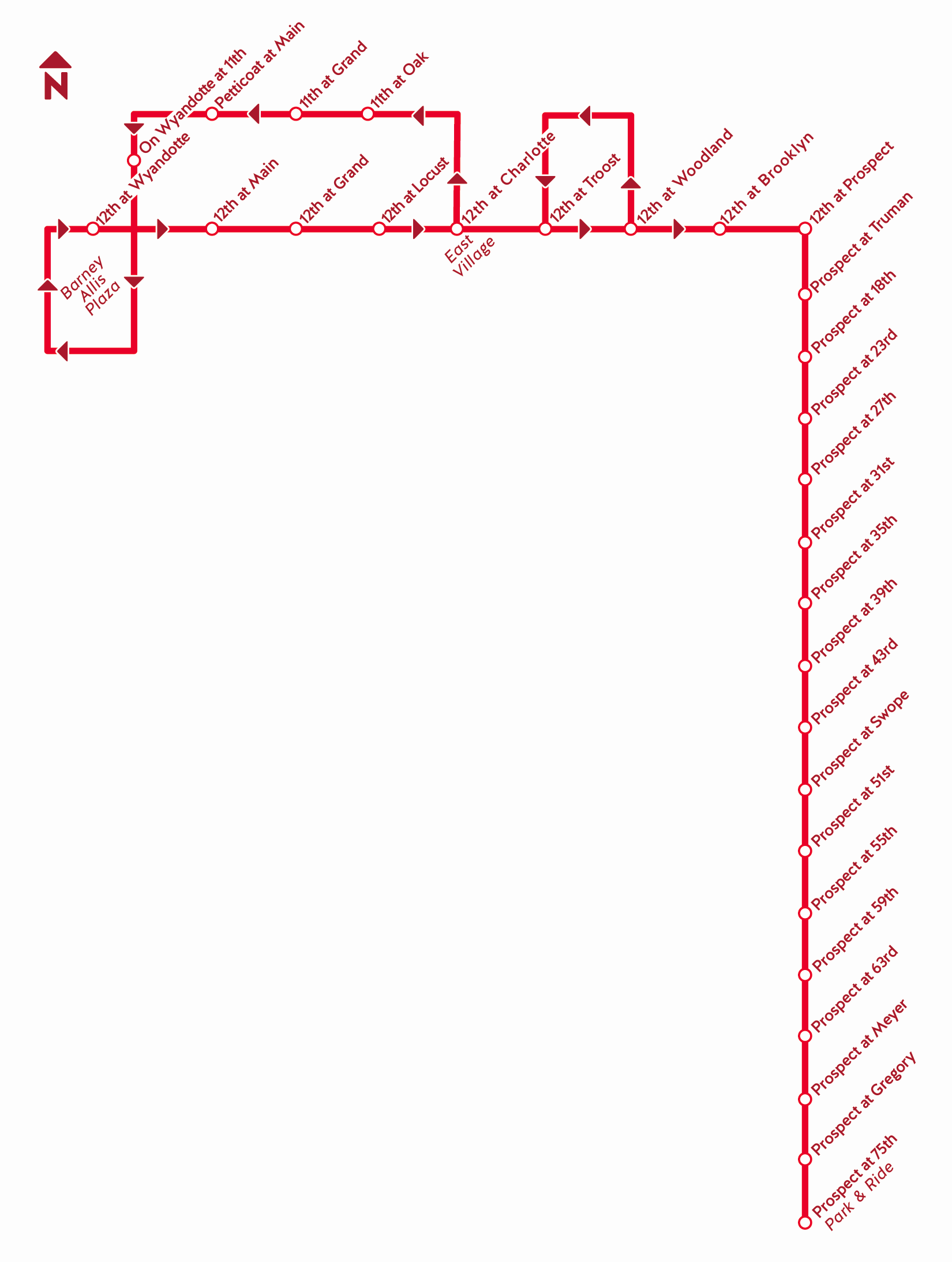
Route Map
Click map for a larger view.
North Oak Study
Connecting the Northland
The North Oak Corridor Transit Study will provide recommendations on how transit services can better serve the North Oak Corridor and surrounding neighborhoods from downtown Kansas City, through North Kansas City and Gladstone. The study team will engage the Northland community to determine transit access needs and services along the North Oak Corridor to make improvements for increasing mobility.
Study Purpose
The study will consider the feasibility of a MAX-level transit investment in the corridor. MAX is RideKC’s Bus Rapid Transit (BRT) service that includes high service levels, increased rider amenities, and rail-like stations. The study will build on existing plans and policies to further land use and corridor development recommendations that would support a significant transit investment in the corridor.
Study Progress
The study team developed three preliminary alternatives (as shown on the map) for fast and frequent service in the corridor. Preliminary alternatives are based on existing ridership and travel characteristics, corridor character, economic development potential, locally expressed desire, transit potential, cost and stakeholder input.
Resources
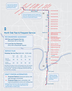
Click to view a larger version of the map. [PDF]
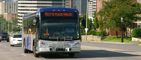
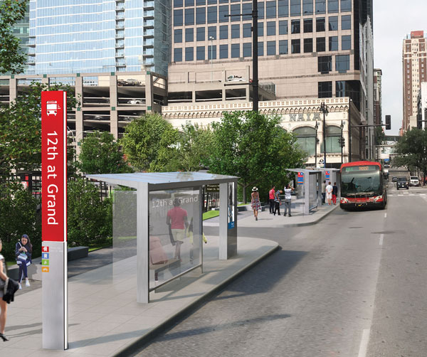
MAX & Bus Rapid Transit
MAX is RideKC’s bus rapid transit line (BRT) serving highly populated residential and commercial corridors in Kansas City, Mo.
Plans are underway to implement this premium service along Prospect Ave. and into downtown KCMO. From its vehicles to service, MAX touts its unique identity. Customers reach their destinations with greater ease because of MAX’s faster, more reliable service. MAX vehicles have a distinctively sleek design, while MAX stations are substantially larger than standard bus stops. In addition, one of the more popular customer-friendly MAX features includes real-time arrival information that helps transit customers know exactly when MAX will arrive.
MAX Features
- Frequent service
- Traffic signal priority
- Fewer stops for faster service
- Highly visible MAX stations
- Sleek, distinctly designed vehicles
- Unique branding
MAX debuted with Main MAX in 2005, changing the face of transit in Kansas City.
Following on the success of Main MAX, a second MAX line was developed for Troost. This line opened in 2011, featuring green technologies such as hybrid vehicles, solar lighting, pervious pavement and rain gardens.
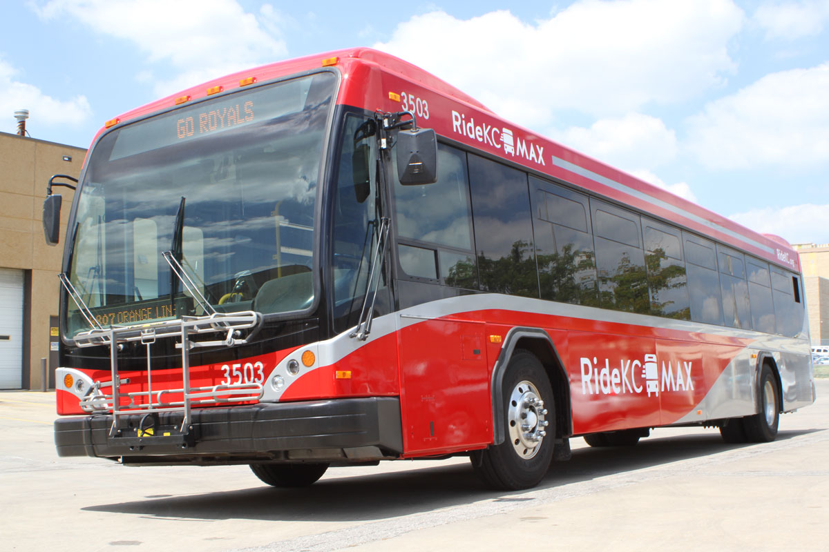
Above: The distinct looking MAX vehicle.
Above: The Troost MAX line features artwork along the line.
Light Rail
In 2008, voters defeated a proposal to fund a light rail line from Vivion Road and North Oak Trafficway to Bruce R. Watkins Roadway and 63rd Street. KCATA is completing Phase II of the Alternative Analysis, which will be available on this website when finalized. Below is information about the project and light rail planning in Kansas City.
Final Land Use Summary
The Final Land Use Report [PDF format] analyzes conditions and current plans and policies affecting development patterns within the proposed transit corridor. The report discussed the proposed route in relation to the federal government’s New Starts criteria. The report also includes recommendations based on both this land use analysis and the real estate market analysis, which assesses the future development potential within several market areas. The project study area is an approximate 12-mile transit corridor between the intersection of I-29 with North Oak Trafficway and US-169 in the northern portion of Kansas City, Missouri to the intersection of 63rd Street and Bruce R. Watkins Drive. The corridor includes the Kansas City metropolitan region’s most concentrated employment and residential areas and many of the region’s significant institutional and cultural attractions.
Assessment of Proposed Light Rail Corridor
This technical memorandum [PDF format] provides a land use assessment for the proposed Kansas City 14-mile light rail corridor. When preparing funding recommendations to Congress, the Federal Transit Administration undertakes a formal evaluation of all projects applying for New Starts funding. This technical memorandum explains the conclusions of a land use assessment. It includes a summary and slide show of the findings. The assessment is based on the FTA land use evaluation process and breaks the alignment into eleven discrete Market Areas. In their current conditions, none of the market areas provide a strong case for benefiting greatly from, or supporting, a light rail line. However, many of the market areas are in flux, or could be redeveloped to become more transit oriented.
North/South Corridor Alternative Analysis Report (Draft)
The North/South Corridor runs from Vivion Road in the Northland to Meyer Boulevard in the south and encompasses many of the region’s most important traffic generators. The Alternatives Analysis is intended to provide decision-makers with the information they require to assess a major investment in transit. North South Corridor DRAFT Alternatives Analysis Report (PDF files) - Chapters 1-2 - Chapter 3 - Chapter 4 - Chapter 5 - Chapter 6 - Chapters 7-11
Next Steps for Light Rail in Kansas City
The results of the Alternatives Analysis will serve to inform the ongoing efforts being led by MARC to develop a long-term regional transit solution.
Video Simulation
A video shows what light rail in Kansas City may have looked like, including the line proposed in the November 2008 election. The video includes stations and light rail vehicles.
BackKansas City Streetcar
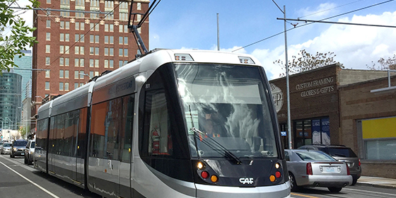
Running from the River Market on the north end to Union Station and Crown Center on the south, KC Streetcar connects all the downtown neighborhoods with 16 platform stops and 2 miles of track. Visit the KC Streeetcar website.
With streetcars arriving approximately every 10 minutes during peak hours, offering level boarding and fare-free, visitors and residents alike can easily explore Kansas City on their schedule using the route map and at stop signage.
The downtown KC Streetcar line is the first step in a regional, integrated transit system connecting the greater metropolitan area. Public transportation creates more vibrant, livable urban centers by attracting new residents and new jobs – which lead to significant economic growth and large investments encouraging even development. With more than $4 billion invested in downtown Kansas City already, the boundaries are limitless. Not to mention, the KC Streetcar is fun and easy to ride!
Getting downtown
Regional zero fare RideKC Bus connections to KC Streetcar can be made at the following locations:
- River Market North, connect at bus stops at 3rd & Grand
- Metro Center, connect at bus stops on 11th or 12th near Main
- Union Station, connect at bus stops at Pershing and Main or Pershing and Grand. The Link walkway connects Crown Center and Union Station.
Plan your connecting trip at ridekc.org or use the free Transit app.
Parking Downtown
Ample parking along the route is available. Drive on over then let the KC Streetcar take you from there. And with long service hours (especially on the weekends) you never have to worry about missing the fun or the last streetcar back.
Back
Independence Ave. BRT Study
KCATA has begun a Bus Rapid Transit (BRT) study of Independence Avenue. The study will assess transit options between downtown Kansas City, Mo., to downtown Independence, Mo.
This 9-mile stretch of Independence Ave. is one of the mostly densely populated and diverse areas in the region. The study is seeking an optimal way to connect these two destinations with a premier BRT service while maintaining some level of local transit service as well.
The project potentially could result in the first East-West BRT route in Kansas City. The connection to Downtown Independence would also be the first time service of this caliber would serve an area outside of Kansas City, Mo.
The project team began initial study activities in January 2018, to include data analysis and a review of existing conditions and transit operations in the corridor. Advisory committee meetings and public outreach are begining in Spring 2018. Check out our website and social media pages for updates on the process and public meeting dates and times.
Back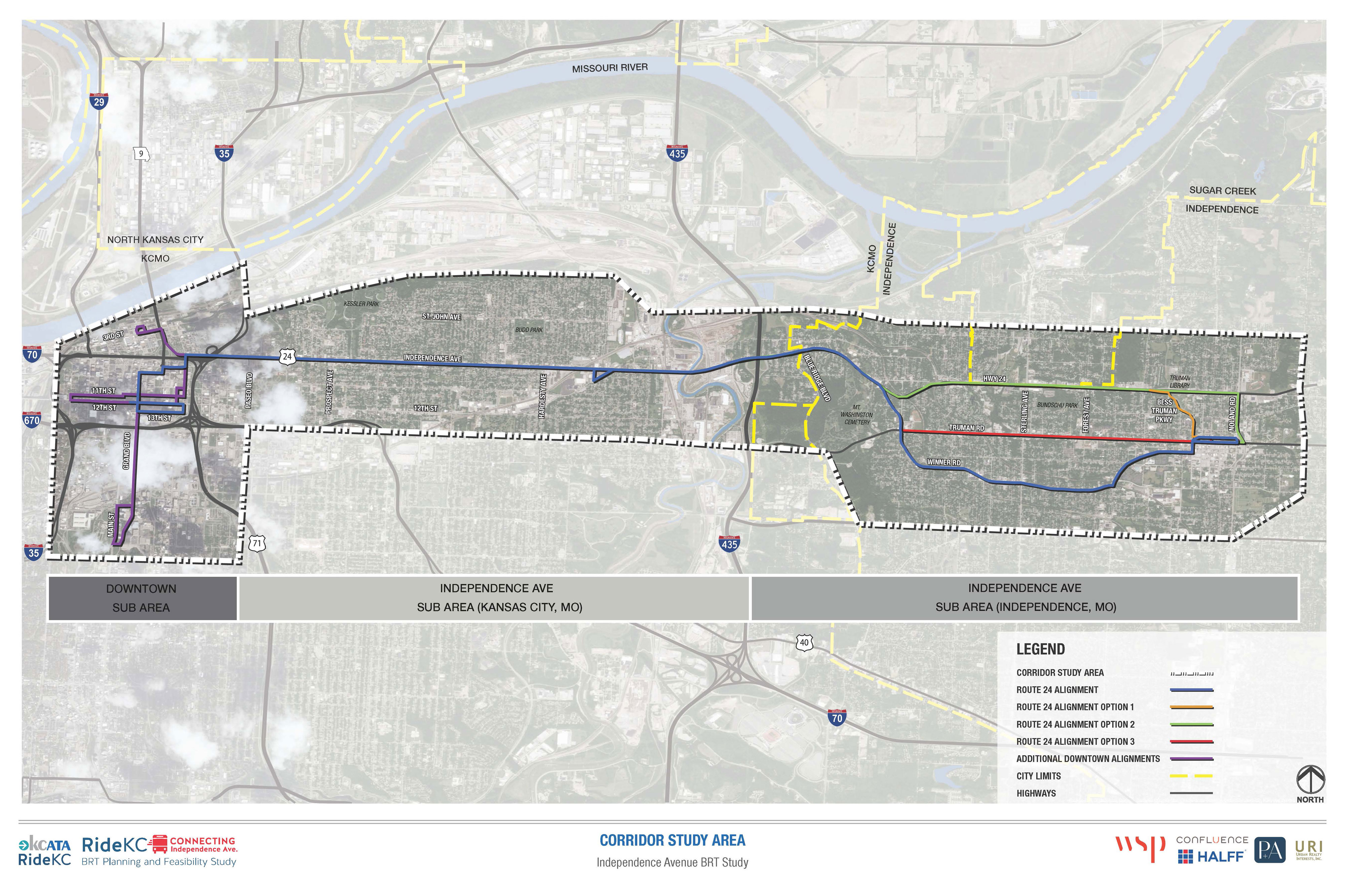
Freedom On-Demand
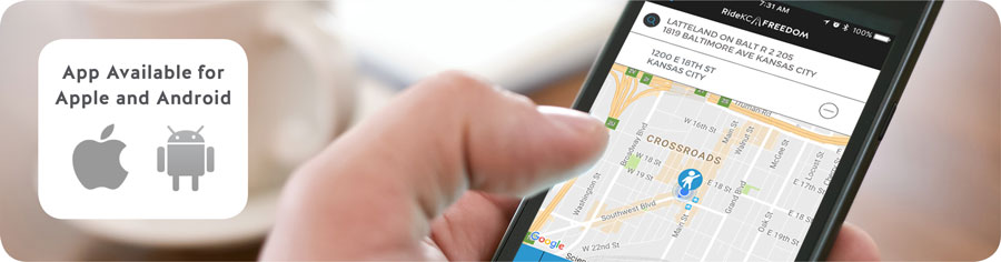
RideKC Freedom On-Demand is a new cutting edge transit option. Freedom On-Demand begins with a strong core service for persons with disabilities and builds on that foundation to provide fast, affordable cab rides for everyone. The app-based service allows anyone to book a cab ride without providing 24 hours’ notice required of paratransit service RideKC Freedom.
Traditional paratransit services in Kansas City is called RideKC Freedom, formerly Share-A-Fare. Paratransit provides specialized transportation for people with disabilities who are not able to fully use the buses or streetcar that are part of our public transportation system.
RideKC Freedom On-Demand is an app-based service. The RideKC Freedom On-Demand app is available in the Google Play store or the Apple App store.
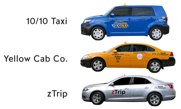
On-Demand program is open to everyone, but only customers who are certified as disabled under the Americans with Disabilities Act in the RideKC Freedom paratransit program qualify for a reduced fare. The general public can use On-Demand services at the regular price of $10 for the first five miles, and is $2 for every mile after. Riders without a smart phone can call RideKC Call Center to connect with a taxi dispatcher.
The pilot program provides subsidized trips for riders with disabilities and non-ADA riders in select areas: all of Johnson County and Wyandotte County in Kansas, and portion of the Northland, and an area south of the Missouri river in Kansas City, Mo. Riders must start their trip within the service area to qualify for reduced fares. Trips that start outside the subsidized service area will cost the general public fare.

Downtown Service Improvement Concept
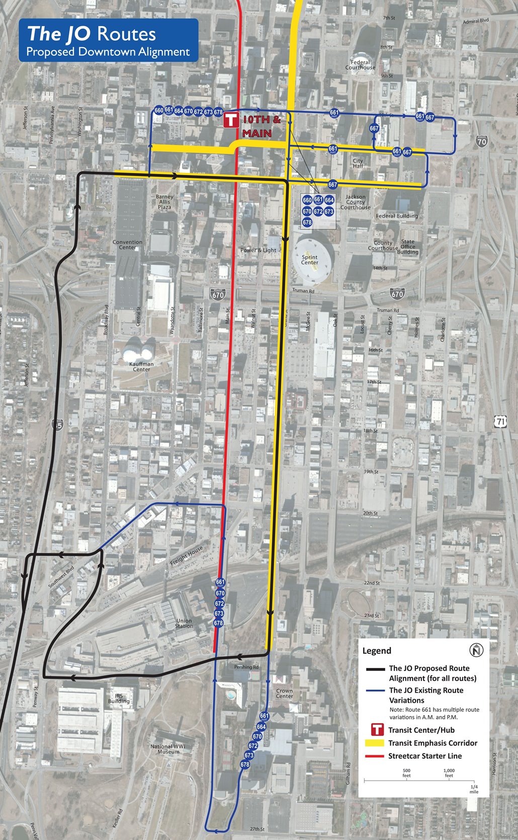
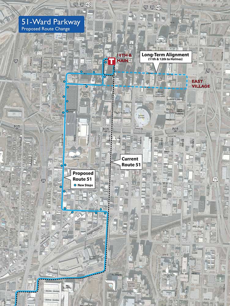
Downtown Kansas City, Missouri, is currently served by 42 KCATA and eight Johnson County Transit “The JO” bus routes, designed primarily to transport workers into and out of downtown. The major focal point of service is KCATA’s 10th & Main Transit Center, but its small size requires many routes to operate to other locations in downtown. Consequently, there is currently little consistency in how bus service operates downtown. With development of new convention, sporting, and cultural facilities, Power and Light District, and more people moving downtown, travel demands are changing. This concept is designed to improve downtown transit service, better meet the evolving needs of Kansas City, and provide a better balance of service to residents, workers, and visitors.
Proposed Improvements
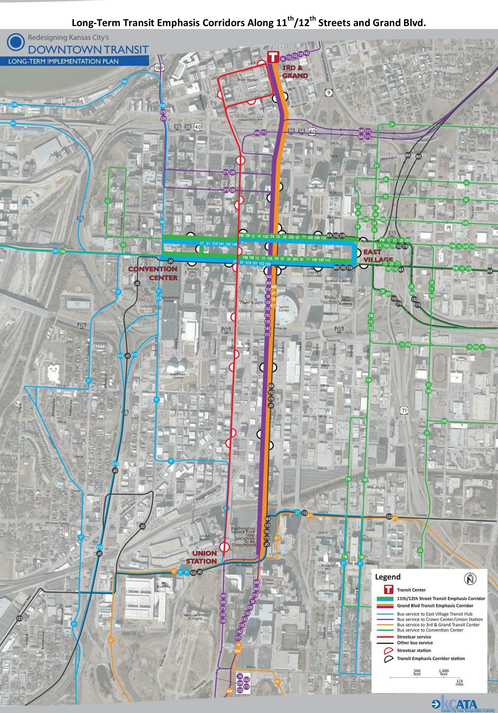
The proposed downtown service improvement concept includes the following interrelated elements:
- The reconfiguration of downtown routes based on an intersecting trunk route service design, forming Transit Emphasis Corridors (TEC) along Grand Boulevard and 11th and 12th Streets to simplify, accelerate, and improve downtown transit service.
- Facilitate connections between bus routes and streetcar service.
- Bus lanes on Grand Boulevard and on 11th and 12th Streets to make service faster and more reliable.
- The consolidation of regular bus stops into Transit Emphasis Corridor (TEC) Stations to make waiting more comfortable and service faster. TEC Stations would provide facilities and amenities similar to MAX stops.
- The development of a new East Village transit hub to improve connections and elimination of 10th & Main Transit Center.
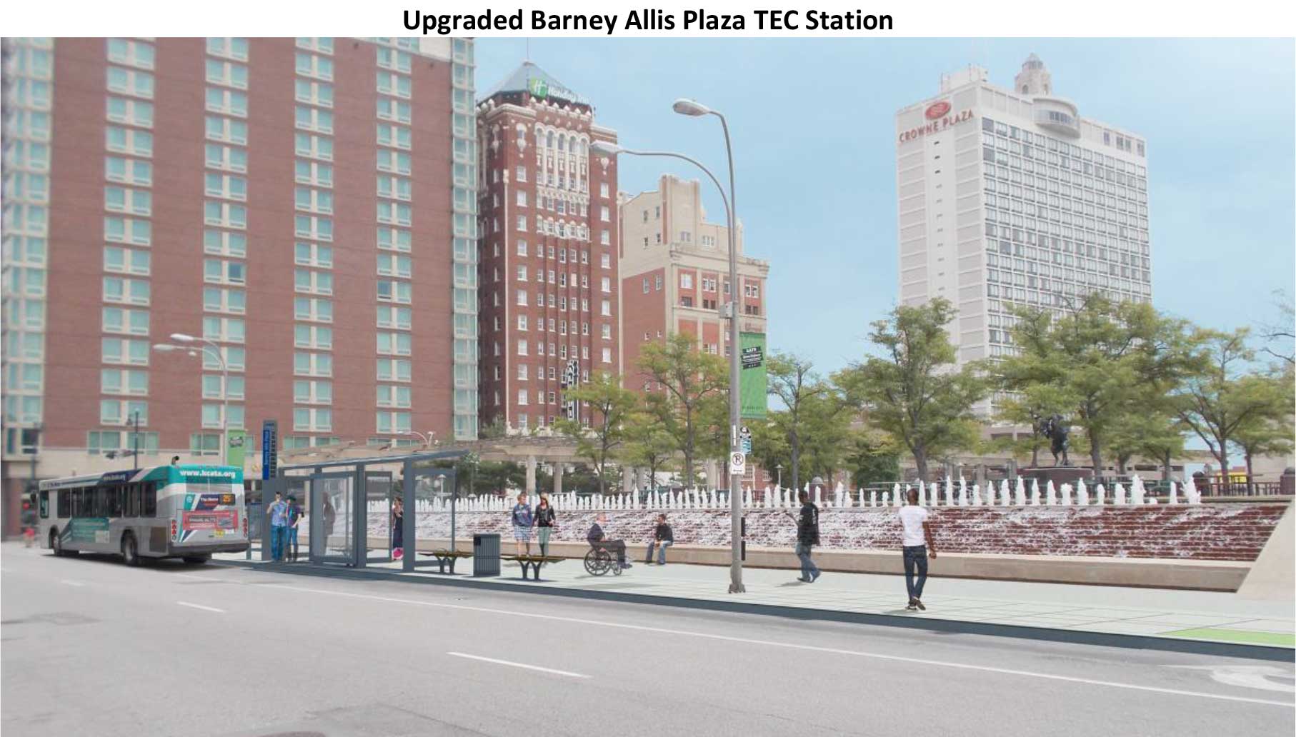
Upgraded Barney Allis Station (Proposed) (click for larger view)
Map of Transit Emphasis Corridors Along 11th/12th Streets and Grand Blvd. (click for larger view)
Map of Proposed Downtown Alignment of JO routes (click for larger view)
Proposed near-term changes to 51-Ward Parkway (click for larger view)
Presentation from Feb. 11 meetings [PDF, 3MB]
Back
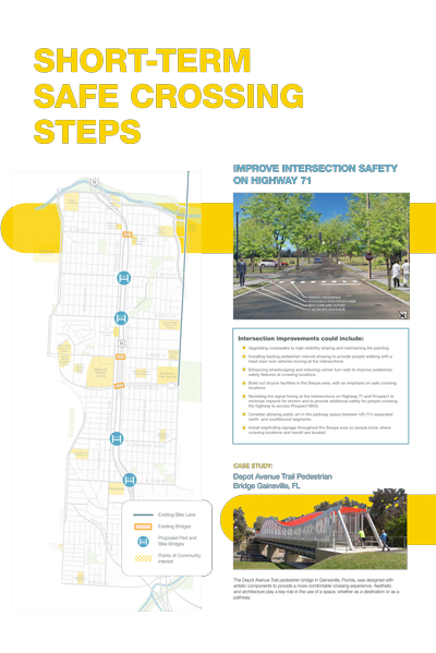
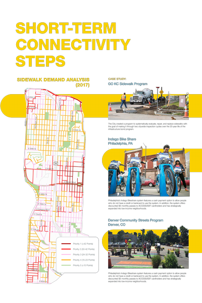
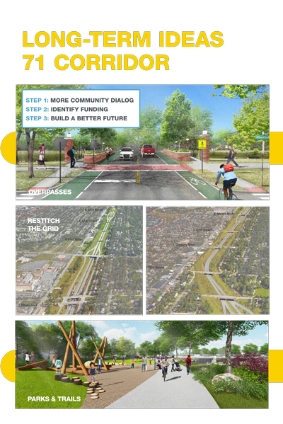
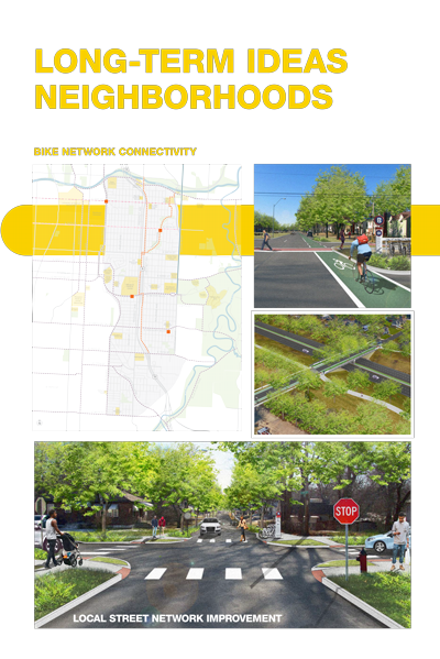
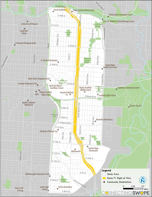
Connecting Swope Study

Project Overview
Prospect Avenue has some of the highest bus ridership in the region and in late 2019 was converted into a bus rapid transit (BRT) corridor - Prospect MAX.
U.S. 71 Highway runs a block east of, and parallel to, Prospect Avenue between Swope Parkway and 75th Street. For potential transit users, pedestrians, and bicyclists, there are few opportunities to cross the highway, high vehicle speeds, and wide intersections that all hinder accessibility.
The Connecting Swope Project will identify ways to improve connections across U.S. 71 Highway to the Prospect MAX line. Building on the needs expressed in past studies, the team will recommend projects and programs that address issues of access, safety, convenience, and comfort in the area.
The goals of the study were to:
- Identify barriers and gaps in connectivity for pedestrians, transit riders, and bicyclists;
- Ensure access to the Prospect MAX bus rapid transit stations; and
- Improve the safety, comfort, and ease of crossing U.S. 71 Highway.
Study Area
This study is focused on improving travel from Swope Parkway to 85th Street and The Paseo to Cleveland Ave.
Background
This project is being closely coordinated with the KCATA Prospect MAX line and the KCMO Prospect Corridor Streetscape project.
Funding for the initiative is provided by the Mid-America Regional Council (MARC) Planning Sustainable Places program.
This study will last from July 2017 through May 2018.
July 2018 Meeting Materials
KCATA and consultants met with neighbors in the study area to present possible solutions and gather feedback.
Presentation and boards from the meeting
Powerpoint presentation. [5 MB, PDF]
Click each image to view a PDF.